Introduction
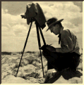
The Santa Rita Experimental Range (SRER) has an archive of photographs taken repeatedly over the years from 124 sites throughout the range. The map below shows the location of the photo sites. Select a site from the map or from the list to see the photographs from that site.
Site 042 has the most complete set of photos taken from 7 different directions.
Search for photos
Find photos from map

001,
018,
029,
033,
042,
045,
051,
053,
055,
058,
060,
061,
063,
065,
066,
067,
068,
069,
070,
071,
072,
074,
075,
076,
077,
078,
079,
081,
082,
083,
086,
089,
090,
091,
092,
093,
096,
097,
102,
107,
108,
109,
110,
111,
112,
114,
116,
119,
120,
122,
126,
127,
131,
132,
133,
134,
148,
149,
150,
160,
175,
179,
180,
181,
183,
219,
220,
221,
222,
224,
228,
229,
230,
231,
233,
234,
237,
239,
240,
241,
242,
244,
245,
246,
247,
249,
250,
251,
252,
254,
255,
256,
262,
265,
266,
268,
269,
270,
273,
274,
277,
279,
280,
281,
283,
287,
289,
290,
292,
293,
297,
298,
299,
301,
303,
304,
332,
333,
334,
335,
336,
337,
338,
339
[SRER Top Page]